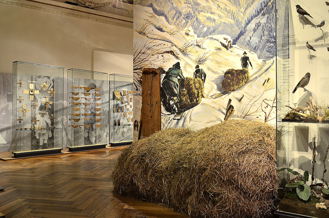
On your way through the following rooms, you will learn more about the natural and cultural history of the Liezen district.
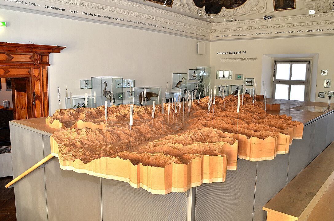
The district reaches from Mandling in the west to Wildalpen in the east, and from the Styrian Salzkammergut in the north to Treglwang in Paltental.
Covering a total area of 3,315 km², it is the largest administrative district in Austria (considerably larger than the Federal Province of Vorarlberg) with a population of around 80,000 (1 January 2019).
Trautenfels Castle
Landscape Museum
Content in other languages
Here you can find content in other languages.

Image Credits
1 About our Museum
In the course of time...
... mountains become lower and rocks rounder, rivers cut deeper, and as things begin to fill the museum with life, all that seemed insignificant becomes fascinating, the long forgotten resurfaces and the banal turns into something special, we begin to comprehend the past and see some things out there in a new light. In the course of time.
2 Forest and Timber
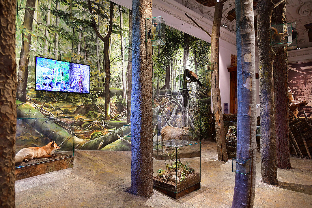
More than half of the area of the Liezen district is covered by forest. People from this region have always needed huge amounts of wood for housing, crafts and industry. Due to its continual exploitation, the natural forest is increasingly being replaced by commercial woodland.
Woodland world
The forest is a highly developed ecosystem in which plants and animals exist.Small plants, organisms living in the forest soil and a whole host of useful bacteria are important for it to thrive. In a healthy forest, you will find nutrients in a continual cycle. They are absorbed by the tree roots and return to the ground in the form of leaves and needles. There they are split up by micro-organisms and thus fed back into the cycle.
Primeval forest
In a natural forest, a great variety of animals and plants live together in various stages of development. Leaves, needles, rotten branches and trunks contribute to the formation of humus and subsequently to the growth of plants. Living trees and dead wood guarantee excellent living conditions for a large number of organisms. The death and decomposition of large primeval trees are among the most important requirements for the creation of new life. The eternal cycle of life and death is complete.
Culture forest
As a result of human intervention, the age structure of trees has often been standardised to improve their usage.
However, a forest like that can only offer a suitable habitat for a small number of plants and animals. The canopy of tree tops does not let in sufficient light for the growth of diverse ground vegetation. Today’s culture forests are increasingly cultivated using near-to-nature methods such as single trunk use and avoiding deforestation, therefore allowing light to penetrate the soil and enabling natural regeneration to bring forth a wide variety of species.
3 Between Valleys and Hills
Combined mountain and glacier formation and weathering formed the Enns Valley over millions of years. In a few centuries man changed the landscape through clearing, draining and building.
The continual interaction of nature and culture has characterised the face of our valley.
Agriculture in the Enns Valley
Up until the mid-20th century, the meadows of the Enns Valley were often flooded, therefore only yielding low quantities of poor-quality hay. After
regulating the River Enns and draining the valley floor, however, even cereal crops were able to be cultivated in particularly favourable places.
Flowing waters, riparian forests
Areas occasionally flooded by streams and rivers are known as flood plains. In the higher bank zones riparian forests were able to grow. Despite human interventions, parts of these forests on the Enns have been preserved.
Standing waters, lakes, lakesides
Numerous plants have developed strategies to hold their own in the water. They live submerged or on the water surface, rooted or swim freely. The shallow banks are mostly overgrown with reeds.
Corncrake
The corncrake was once a widespread breeding bird found in lowland pastures and river valleys. Due to a loss of its natural habitat, it is today threatened with extinction.
Wet meadows and litter-meadows
These meadows were created after clearing carr woodland or by draining the fens. They are only cut once in the autumn which guarantees the existence of numerous wetland plant species. The hay that is poor in nutrients is used as stable spread.
Fens and bogs
Where groundwater almost reaches the surface of the earth, fens are usually formed. Parts of plants do not decom-pose completely thus causing peat formation. The peat bodies of bogs are lentil shaped and domed. As opposed to fens, the roots of the plants can no longer reach the groundwater.
Slope forests
Different types of forest developed in the Enns Valley depending on the soil conditions. Beech, spruce and pine particularly like taking root on chalk. Spruce and pine forests grow predominantly on the siliceous bedrock of the Tauern slopes of the valley. In higher areas, larch trees are mainly found alongside spruces.
Tree line
Up to a tree line of about 1900 to 2000 m altitude, the forests become ever sparser. Swiss pine and dwarf pine characterise the alpine pasture region.
Intensive alpine pasture cultivation has opened up existing forest cultures.
Grassland and dwarf-shrub heath above the tree line
Above the tree line only dwarf shrubs, herbal plants, algae and lichen are able to survive. The reason for this is the barren ground and the rough, stormy climate.
Rock and scree fields of the summit region
Plant rootage is possible even in the smallest of cracks in rocks and scree slopes. On the constantly moving scree slopes, flowering plants or moss can be found. On the bare rock, only algae and lichen thrive.
Rock strata north and south of the Enns
The Enns Valley is situated on an extensive east-west fault line of the earth’s crust. It divides the morphologically contrasting rock formations of the Limestone Alps in the north from the slate and gneiss of the Lower Tauern in the south. The fossils found in the rock strata of the Northern Limestone Alps prove that they were formed in sea basins. The depth of the sea has changed constantly over millions of years. Ammonites are a sign of deep water, coral, and sea lilies point to shallow water bathed in light. The slate and gneiss of the greywacke zone and the Lower Tauern (Central Alps) south of the Enns were created under great pressure and temperatures from sand and clay deposits. In the process beautiful minerals were formed in some places.
4 Objects of Beauty
There are many things in nature that we find beautiful, which also means that they become more important to us. They also, however, awake the desire to shape one’s personal surroundings.
“Everything is beautiful if you look at it with love.”
(Christian Morgenstern)
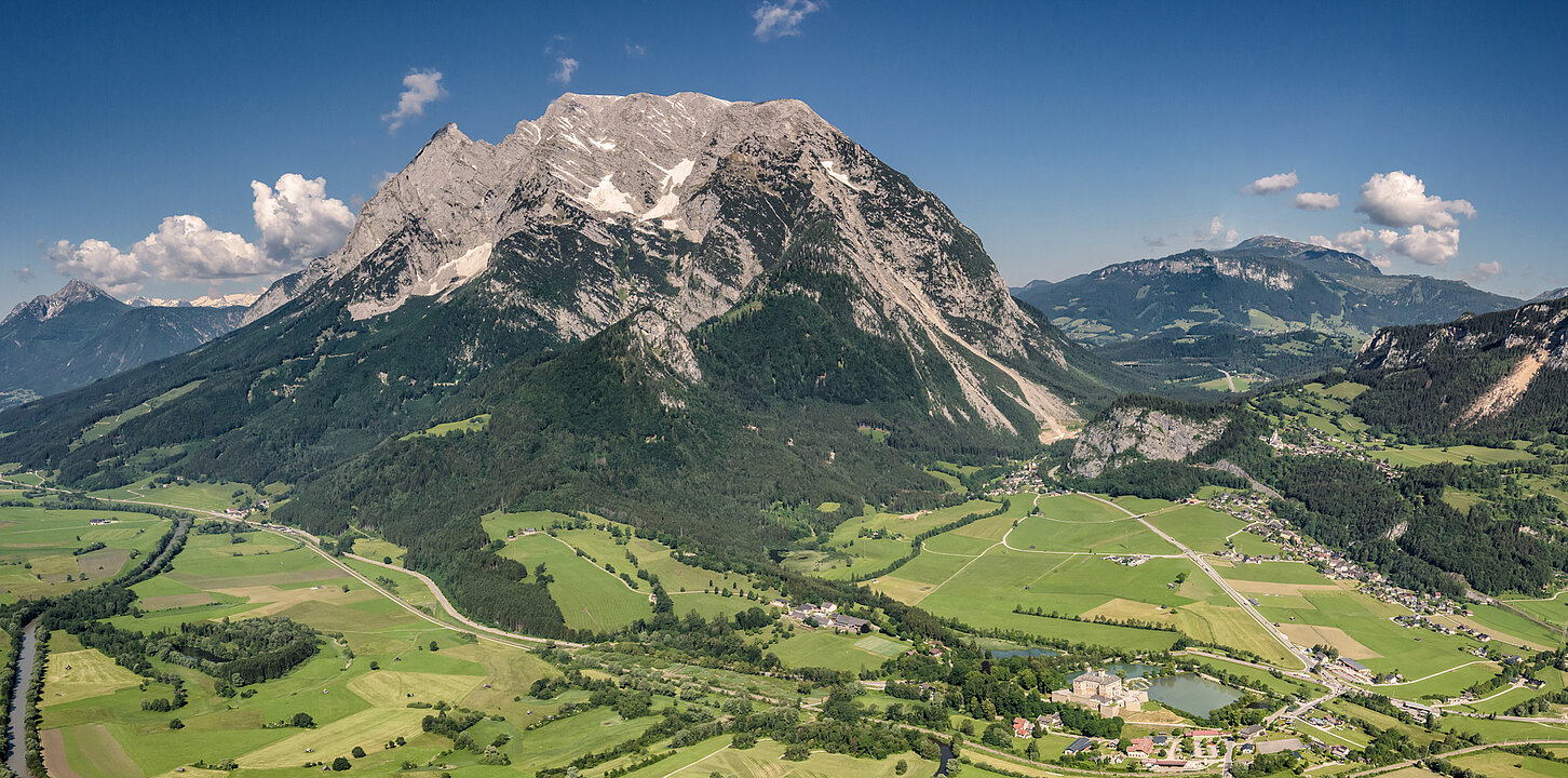
View of the Grimming
It is difficult to describe how an individual experiences the beauty of the countryside. It is even more difficult to express a landscape in words as it is infinitely vast, bizarre and diverse. And you really need to take your time to enjoy the peace and quiet of a serene landscape.
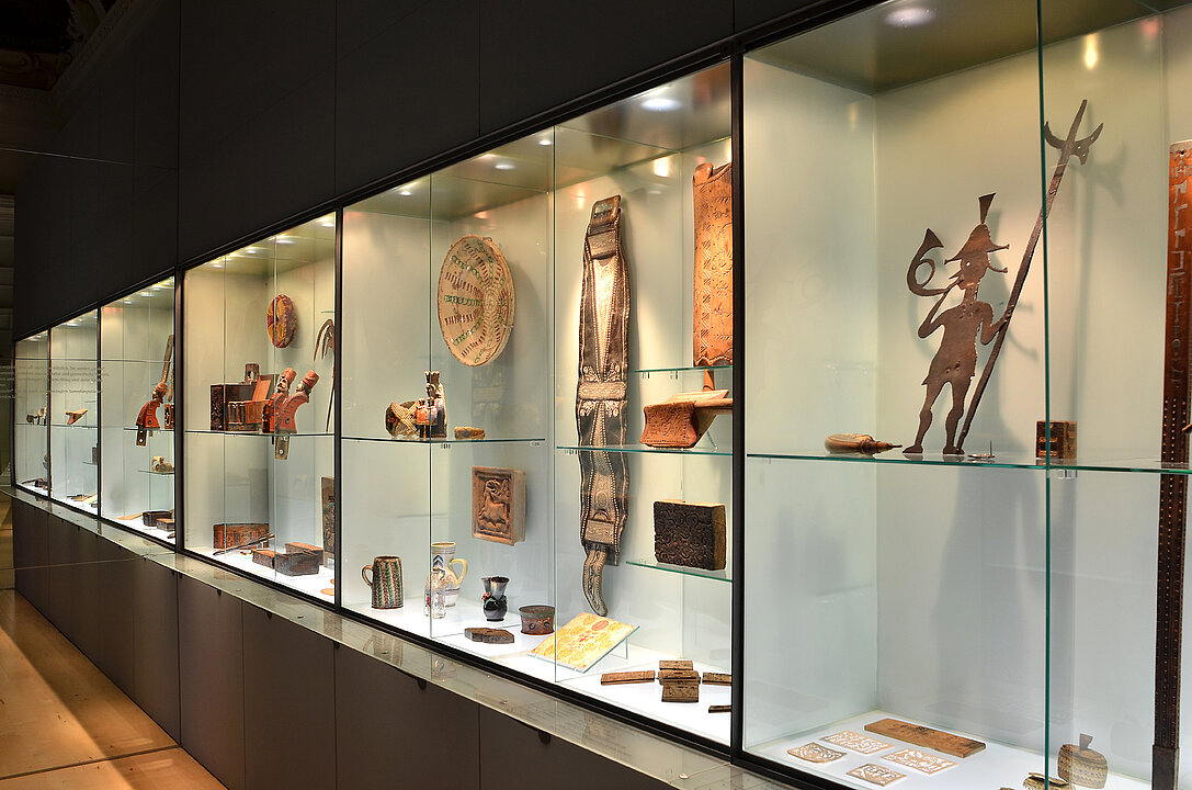
Folk art
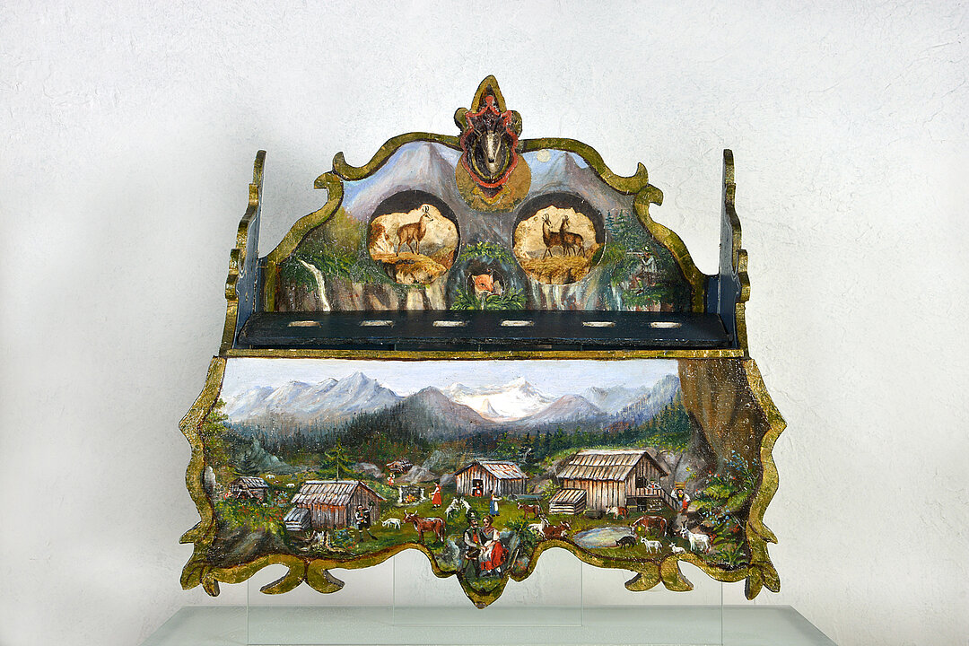
Commodities are not only useful, but can also be designed and decorated “nicely”. Examples from nature and geometric shapes, religious symbols and representations of everyday life are motives frequently chosen for this purpose. They are amongst the museum’s most popular collection pieces because of their “decorative” appearance.
5 True Faith
In the 16th century Martin Luther’s teachings spread all over Roman Catholic Upper Styria. Over 80 % of the population converted to the new faith. Protestant life, which flourished until 1599, was violently suppressed during the Counter-Reformation. Despite this, the Protestant faith was able to hold its ground in secret until the Edict of Tolerance in 1781.
The Protestant church in Neuhaus
A Protestant centre in the Enns Valley was the Neuhaus church. After a short period of prosperity lasting 25 years it was razed to the ground in 1599. In 1992 archaeologists uncovered the remnants of the foundation walls. The area is today a memorial and can be reached on foot in fifteen minutes from Trautenfels Castle.
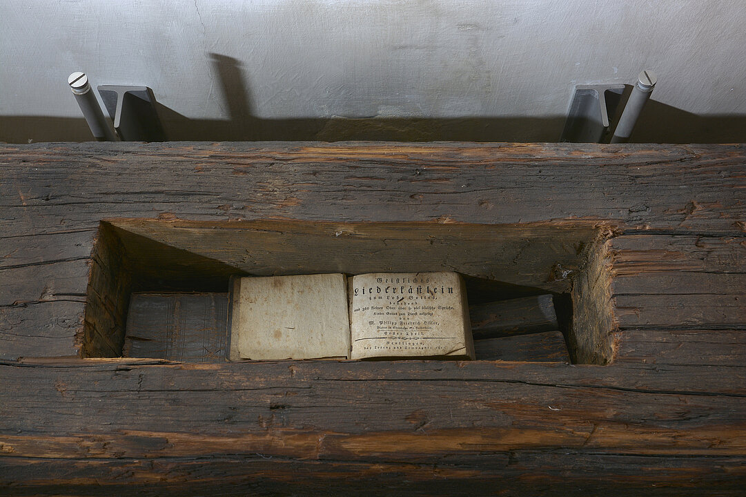
Smouldering embers under the ashes
Many Protestants remained true to their faith even after the Counter-Reformation. The principal element of the Protestant doctrine is the Word of God. For this reason the interpretation of the Bible and other scriptures constituted the focus of secretive family worship. The
Protestants concealed the banned books in carefully chosen hiding places.
Pilgrimages to the Mother of God
After the Counter-Reformation, religious life in the Roman Catholic church was renewed thoroughly. One expression of this fundamental attitude was the sharp rise in pilgrimages and processions, principally to shrines of the Virgin Mary. By adhering to such doctrines, the Catholic Church deliberately distinguished itself from Protestant doctrines which principally disapproved of pilgrimages.
6 Social Life
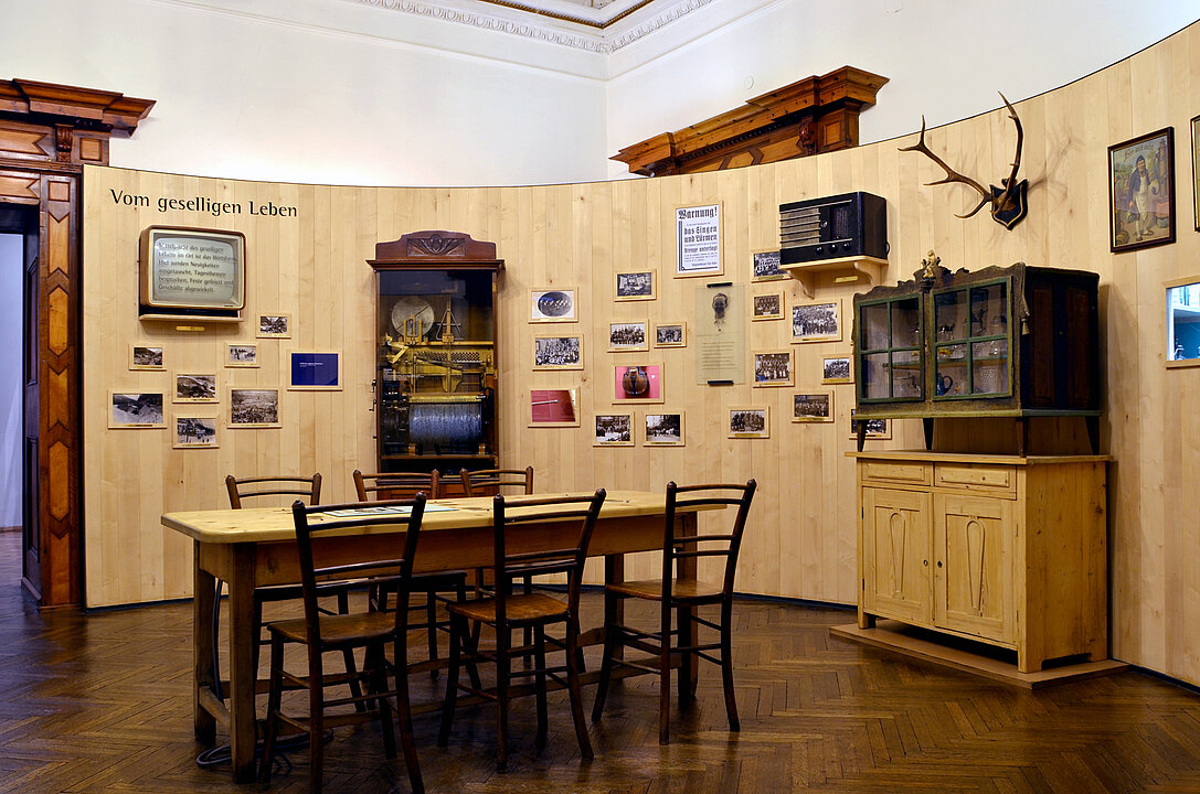
The focus of social life in the community is the inn. Here, news is exchanged, daily topics are discussed, parties are held and business is concluded.
Poachers
The hunt was until 1848 a privilege of the aristocracy. Need and passion for hunting led many men to “poach”, i.e. to hunt illegally. Poaching was not only an adventure, it was often essential in order to feed large families. These “illicit hunters” were secretly admired by large parts of the population.
The hunt of the common man
In the Salzkammergut region, the trapping of songbirds was permitted in 1579. This hunting with birdlime rods and nets was restricted to red crossbills, goldfinches, bullfinches, siskins, waxwings and bramblings. The birds were kept in the house over the winter and well cared for. There were public exhibitions and prizes for the best specimens. In Styria, bird trapping was banned in 1992.
At the local pub
Many groups and associations meet regularly at their favourite inn where reserved tables are often marked with traditional guilds’ coats of arms, badges of trade or other symbols. Prizes from competitions won or club photos bear witness to their activities.
Music and dance
On special occasions musicians would play music for dancing. The most popular instruments were the zither, violin, harmonica and flute. Musical instruments hanging on the wall of most inn parlours were often played spontaneously by guests.
Cooling with natural ice
Before the invention of the electrical refrigerator people were only able to cool food with the help of natural ice. The first fridges had compartments for ice blocks which, however, always had to be refilled. During the winter season, the men cut blocks from the frozen lakes with ice saws. They pulled the ice out of the water with pliers. The blocks lasted until the summer as they were stored in insulated cellars.
7 Clothing
Clothes protect, absorb, repel, warm, cool, adorn, enchant, charm, seduce, transform, cover, bewilder, confirm, unsettle, conceal...
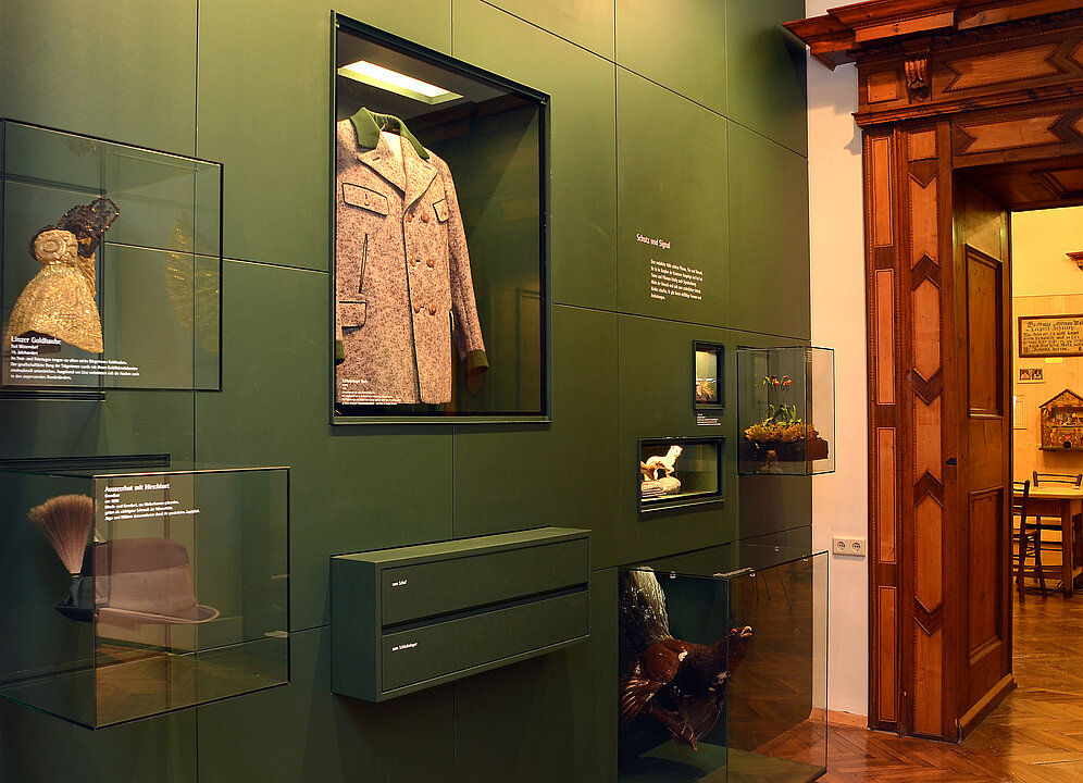
Protection and signal
Plants, animals and humans are protected by a natural covering which often has a signalling function for them. Only humans needed clothing for additional protection, which was accordingly given varied forms and meanings.
From our textile collection
The German word for clothing “Tracht” actually means “what was worn”. Clothing was determined by social and economic relations. Up to the 19th century regional differences had been developing, and traditional forms of clothing were revived in the 20th century. They were changed according to the tastes of the particular time and declared as valid forms of dress for certain regions.
Most clothes were worn until they were completely threadbare. Often old Sunday clothes ended up as day-to-day clothes. This is why in many museums – as in ours – only individual garments or valuable festive dress can be found.
8 Working life and customs
Day and night, summer and winter have always determined the lives of man, animals and plants. Before the dawn of industralisation, rural life was even more in tune with the natural course of the seasons than it is today. Characterised by long hours of hard work, the summer season was governed by the length of day and growth of vegetation. In the winter there was more time for socialising and customs.
Alpine agriculture
The basis of the farmers’ living in mountainous regions was livestock breeding. Cereals were only grown for home use. During haymaking and crop harvesting the rural population often had to work 17 hours a day.
9 Treasures of the mountains
Mining and smelting were important sources of income for the population until the 19th century. The mining and processing of a variety of mineral resources promoted economic developments in the region and significantly characterised the cultural appearance of the district.
Early traces
Numerous copper smelting remains testify to the signficance of the mining and iron industry region in Paltental. In 3000 BC copper was already being smelted in simple shaft furnaces and
made into bronze objects.
Working underground
The extraction of silver, copper and iron has lured many people to the mountains since the 14th century – especially to the Schladming Tauern and the Walchengraben near Öblarn. With the simplest of tools the miners dug tunnels and shafts. To go up and down with their heavy loads they used scaling poles.
From raw material to finished product
Until the middle of the 20th century iron was smelted in blast furnaces and was still forged in hammer forges. Large amounts of charcoal were needed for the hearths and water to drive the hammers.
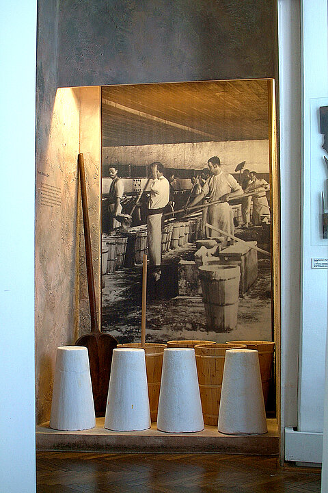
Salt extraction
Ever since the early 12th century the “White Gold” has brought prosperity to the Ausseerland. Today’s salt is washed out of the rock with water and the brine flows through a pipeline to the Ebensee
salt works in Upper Austria for further
processing.
The making of salt
The salt solution used to be heated in large copper pans. The salt makers moved the salt to the edge of the pan which had crystallised through evaporation. Then they shovelled it into a wooden container called “Füderl” where it was compressed by pounding it with a tamping tool called “Possel”. After three hours the salt deposit was tipped out, dried and stored.
A miner’s life
The miners were often only able to return to their families in the valley at the weekend. Working underground and living in common accommodation fostered their feeling of togetherness and trade consciousness. This was reflected in their clothing, beliefs and customs.
10 Housing
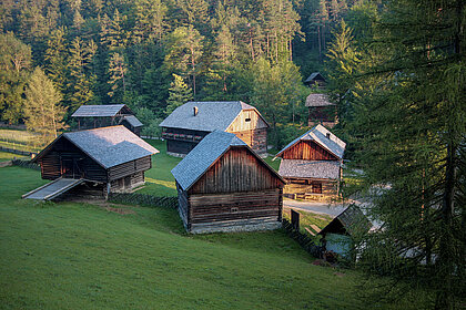
People have always built houses, huts and stables in order to be able to live and work. Their forms and appearances depended on geographical locations and available materials, technical possibilities and manual skills, along with requirements and wealth. People safeguarded their living areas with objects and signs to ward off disasters and protect against storms and evil spirits.
Some animals also build shelters to protect themselves against enemies and bad weather, and to bring up their young.
Types of farmhouses in the Liezen district
In the upper Enns Valley large farmhouses and barns with flat roofs are
typical. The central Enns Valley and Ausseerland are characterised by smaller houses with steeper roofs and several side buildings.
The smoke-stained room
Up to the 19th century the smoke-stained room was very common in farmhouses in the Enns Valley. It was the most important room of the house, serving as a cooking, living and working area, or even to accommodate small animals. A significant feature was the double fireplace with the open stove and oven. Since there was no flue, the smoke filled the upper quarter of the room and escaped through a hole above the door.
Protection against disaster and danger
People believed in the effect of supernatural, unexplained powers. They attributed specific protective powers to certain things such as symbols, words or actions which would protect their living environment from all harm and disaster, while bringing them luck and good health at the same time.
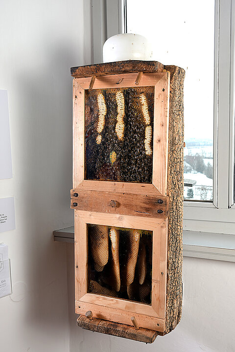
Apiaries
Wild bee colonies lived in dead trees or in cracks in rocks. In order to be able to extract the honey more easily people built hives for the bees. In the Enns Valley these were wooden hives or straw baskets. The wooden beehives were often painted colourfully.
Life of a farm servant
Farm servants spent most of their lives working on farms away from home. Having their own house and a family were pipe dreams for most of them. Their modest belongings were often stored in one single chest. They had not been able to save much more during the course of their working lives.
11 Life on the alpine pastures
In the Liezen district today there are more than 700 partly cultivated alpine
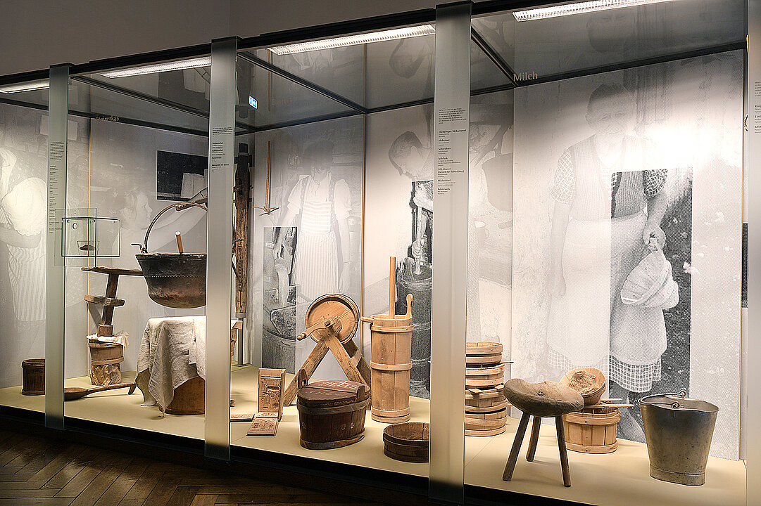
pastures. They often lie up to 10 hours walk away from the farm. In summer the alpine pastures are an independent working area. From the very beginning the work was almost exclusively done by women. As dairymaids they were and still are responsible for the farmers’ livestock and make butter and cheese from the milk.
The alpine pasture huts
Since the alpine pastures were a long way from the farms, dwellings had to be built, for which wood and stone from the immediate vicinity were used... The construction method and style of those alpine pasture huts was similar to that of the farms in the valley.
Livestock
The cows were normally only brought into the cowshed for milking. Sticks with metal rings were used to lure and direct the animals. As they were only there for a short while there was not much cow dung which was quickly removed by the dairymaid.
Milk
After milking the cows, the dairymaid strains the milk and pours it into milk pans (Milchstötzel) to separate the cream. After a while the cream separates from the skimmed milk. When pouring the skimmed milk out, the dairy-maid holds back the cream layer in the pan with the cream spatula.
Butter
The dairymaid beats the lightly soured cream in the butter barrel until a clot forms. She presses the butter into moulds or decorates larger pieces of
butter with stamps and fluted pastry wheels.
Styrian cheese
The soured skimmed milk is heated in a copper vessel where the casein curdles and is separated from the whey by
straining. Using a rack called “Schottwiege”, a linen cloth and a whey tub, the dairymaid presses the crumbly curd cheese out well, seasons it with salt and pepper and stuffs it into a mould called “Kaskee”. After drying, the cheese is left to mature for one to two months before it takes on its typical aroma.
Life of a dairymaid
Due to the responsibility of her work, the dairymaid had a particularly respected position on the farm. Her life was more care-free on the mountain pastures than in the valley because she was outside the social control of the village community. This sentiment is expressed in the saying “On mountain pastures there is no sin”.
Cream spatula
Many of the dairymaid’s working tools, above all the cream spatula, are decorated with blessings or depictions of the alpine pastures and sometimes with geometrical patterns. These were mostly given to the dairymaid by young men as tokens of love.
Butter moulds
The butter moulds are made of five wooden, decorated flaps, which can be
tipped up. The dairymaid presses the butter into the mould to form butter blocks which are decorated on the five surfaces. The dairymaid decorates
the slabs of butter with the fluted pastry wheels.
Coming home from the alpine pasture
The short alpine summer has passed much too quickly. As a thank you for the happy and accident-free time the livestock was decorated in glorious colours for the journey home to the valley.
Change through cultivation
With the increasing use of the alpine pasture region people cleared the surfaces that were once covered with mountainous forests. As a consequence, indigenous species like Ring Ouzel and Eurasian Nutcracker were joined by other birds such as the White Wagtail and Black Redstart.
Hauling hay in the winter
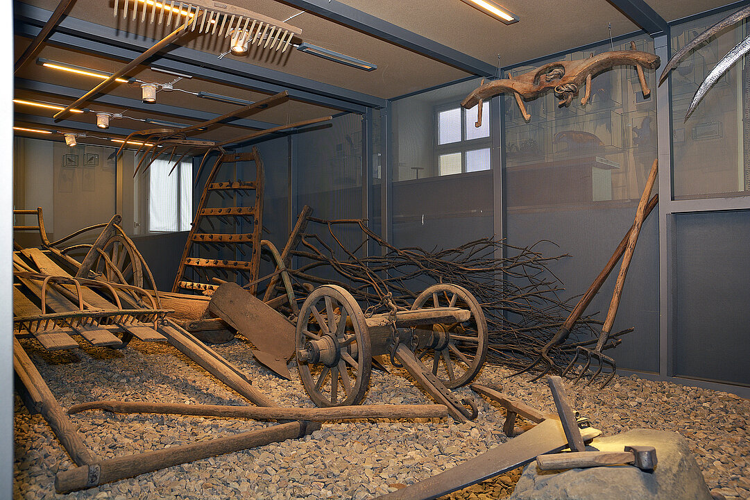
One part of the fodder was mown on hardly accessible, steep, mountainous
meadows and stored in haystacks. Transportation took place in the winter.
The men bound large bales with rope and wooden hooks. With those heavy
loads on their backs they slid down the steep slopes to the valley. On flatter surfaces they put hay boards underneath the loads to be able to pull them better.
12 Hunting room of the Lord of the Castle
Antler furniture was in fashion in the 19th century. Count Josef Lamberg had
the hunting room furnishing done by a craftsman from the region. It is particularly striking because of its careful, mosaic-type workmanship.
The last noble owner
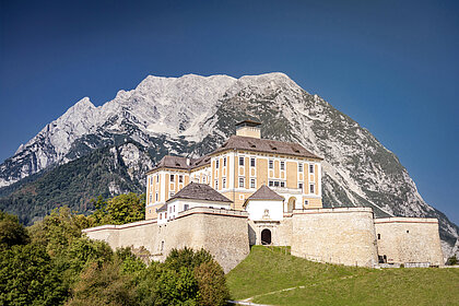
Trautenfels was in the possession of the Lamberg family from 1878 until 1941. During this time the castle experienced a new heyday – it was ambitiously renovated, a new approach road was built and central heating was fitted. In 1941 Countess Anna Lamberg sold the property to the Deutsche Reichspost due to economic problems.
English
Trautenfels Castle
Landscape Museum
Filesize: 3 MB


